


By Kemol King
As the planet gets hotter, wildfires are among the natural occurrences raging through vegetation, threatening communities, and scattering wildlife. While floods are the most typical of Guyana’s natural disasters, 2024 will be remembered as the year when 5,000 square miles of the country’s land burned.
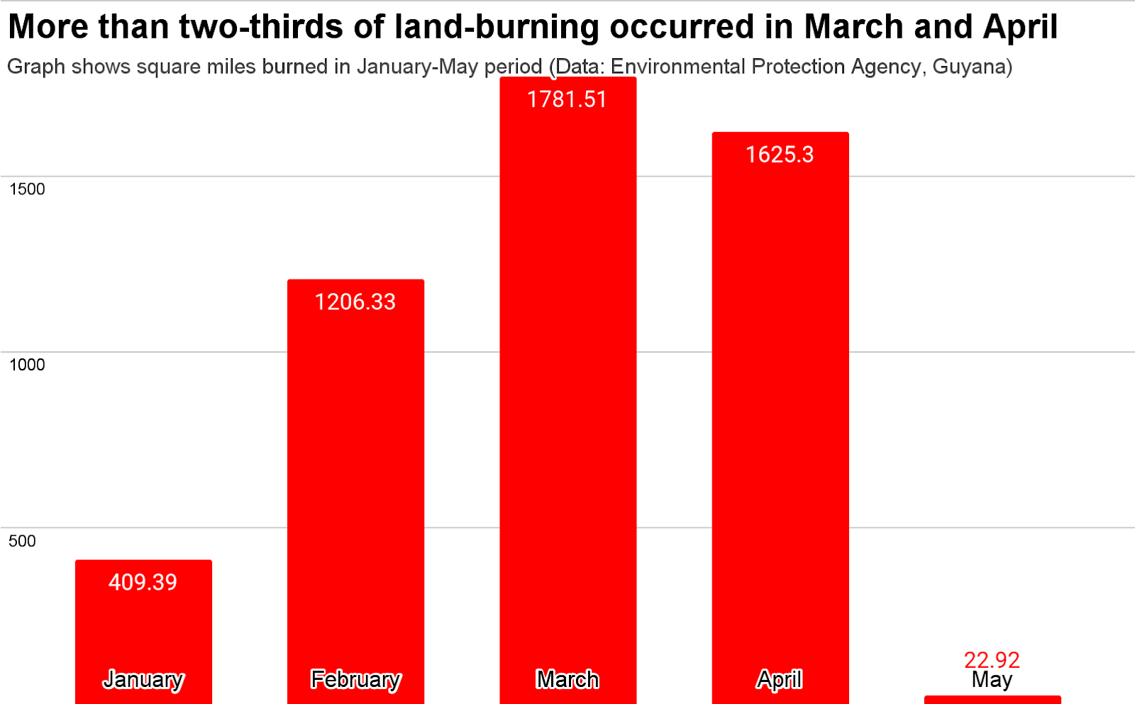
Guyana’s Environmental Protection Agency (EPA) said that a total of 91,128 fires were recorded from January to May. With May having the lowest count and March having the highest count of wildfires, the EPA said a total of 5045.45 square miles of land were burned over the five months. This is significant, not only in absolute terms but also because it represents 6% of the country’s land mass of 83,000 square miles.
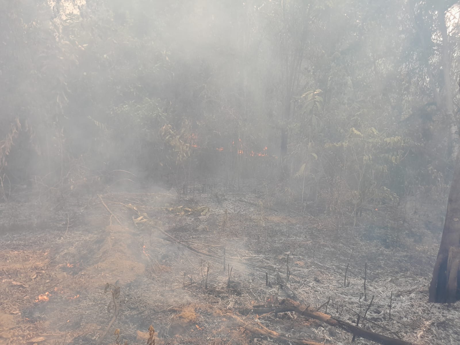
For two consecutive years, air quality sensors reported degraded air quality due to wildfires in Regions 2, 3, 4, 5, 6, 9, and 10, the EPA said. The regulator reported that Regions 2, 3, 5, and 6 experienced fires of large-scale magnitude as the fire engulfed agricultural plots and mangroves, while Regions 1 and 10 experienced wildfires in forested areas in close proximity to people and Shell Beach, a protected area.
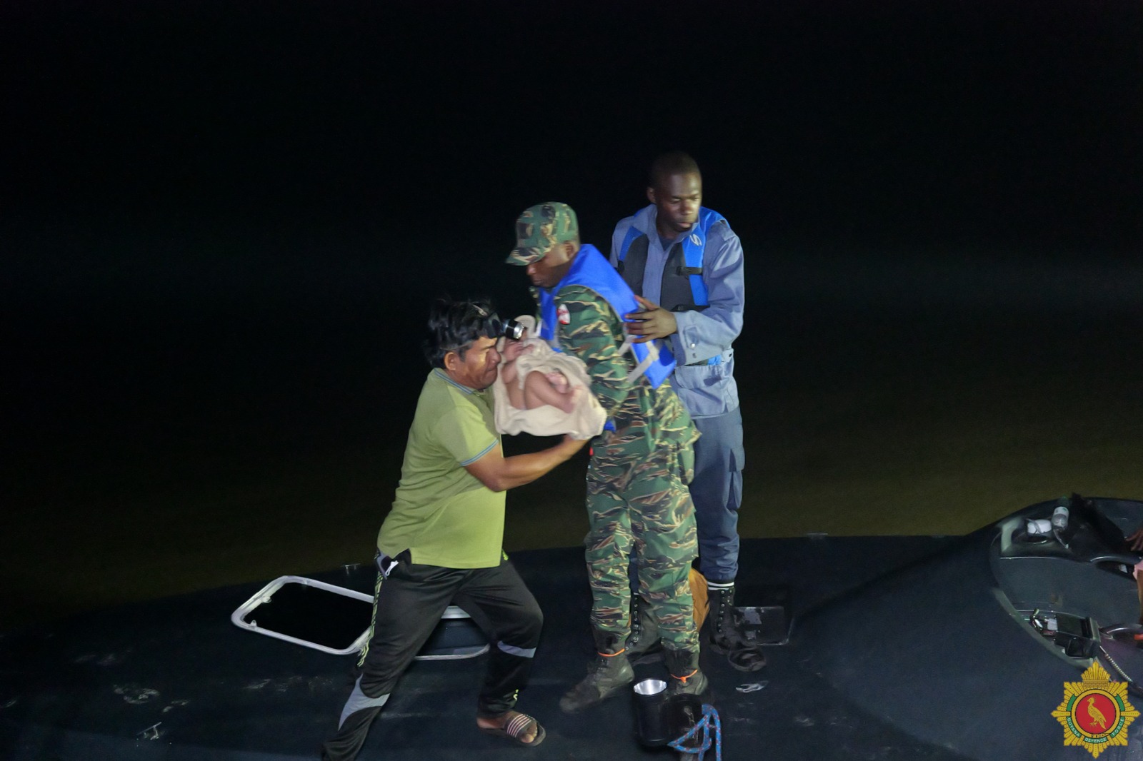
Coastal residents took to social media to express concerns about respiratory issues caused by smoke inhalation. In one of the villages in Region 3, Santa Aratak, the Guyana Defence Force (GDF) had to evacuate 38 residents due to the increasing threat of a nearby bush fire.


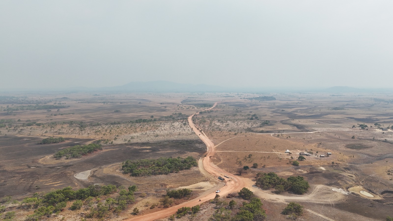
Region 9, the savannah-covered region, recorded fires with the largest magnitude and lifespan since the region is dry, hot, and has lots of dry vegetation (fuel), the EPA said. Emergency responses were launched for Regions 1 and 9 to increase capacity on the ground since the fires were spreading into protected areas and indigenous communities.
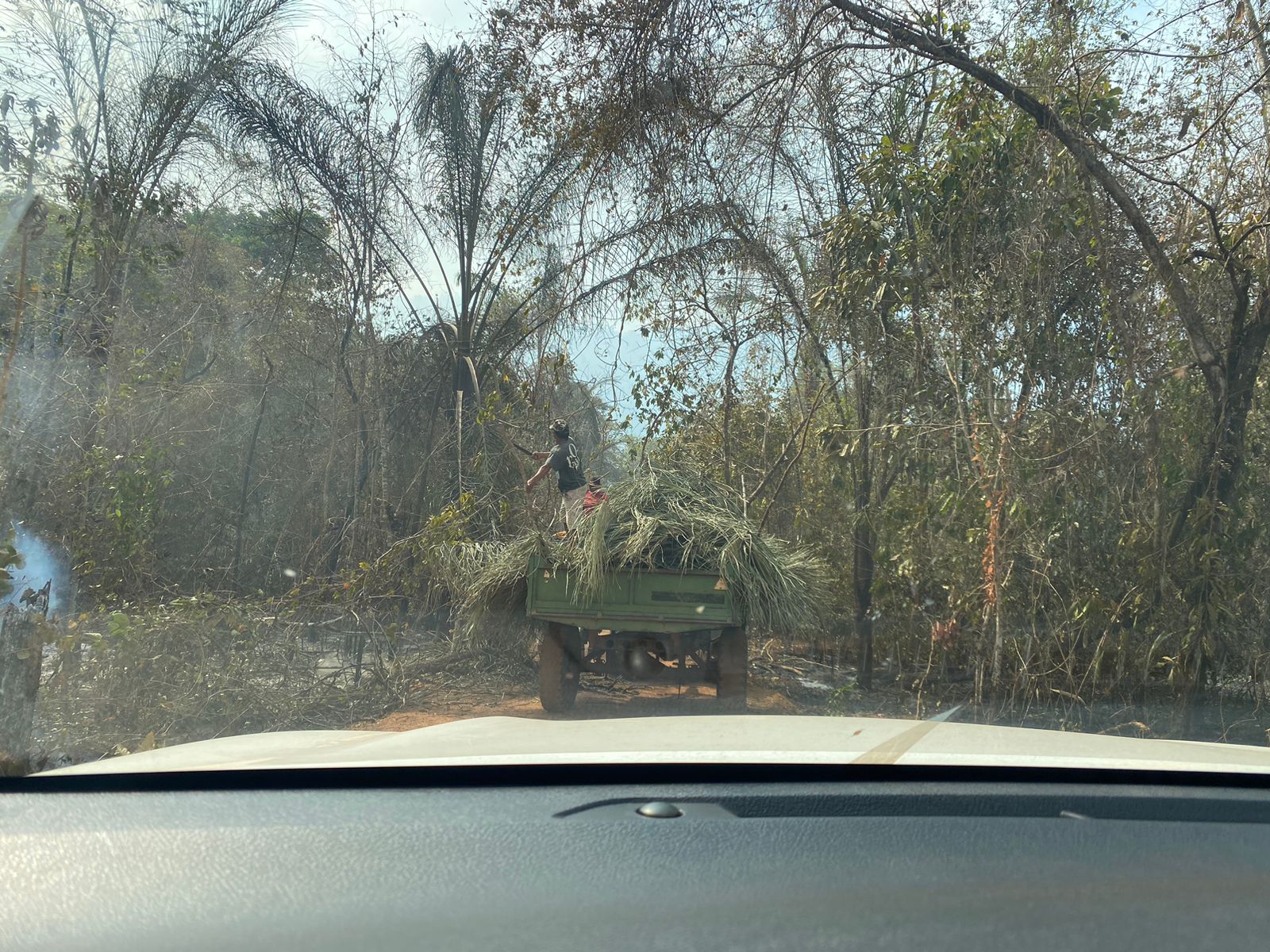
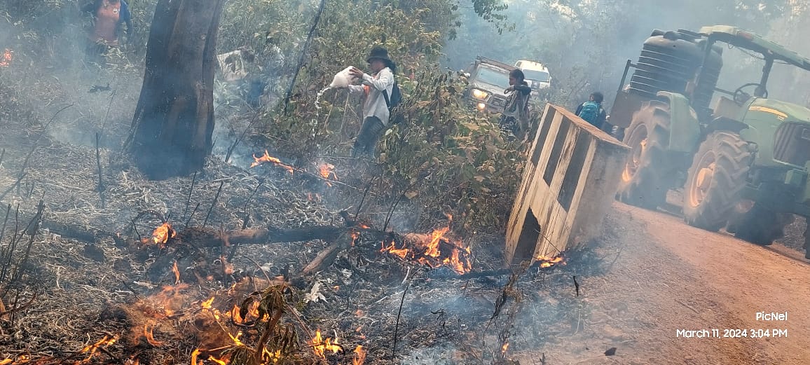
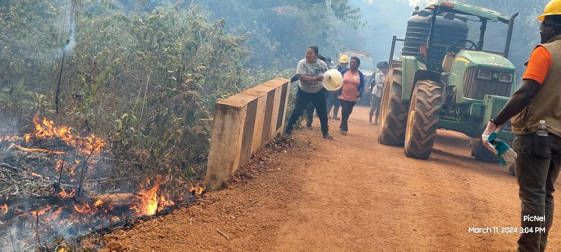
On March 11, as fires approached a developing hydropower project at Kumu, villagers initiated firefighting efforts using local resources. They used a village tractor retrofitted with a water tank and pump. The Guyana Fire Service soon joined, and together they managed to control the blaze after an eight-hour operation.

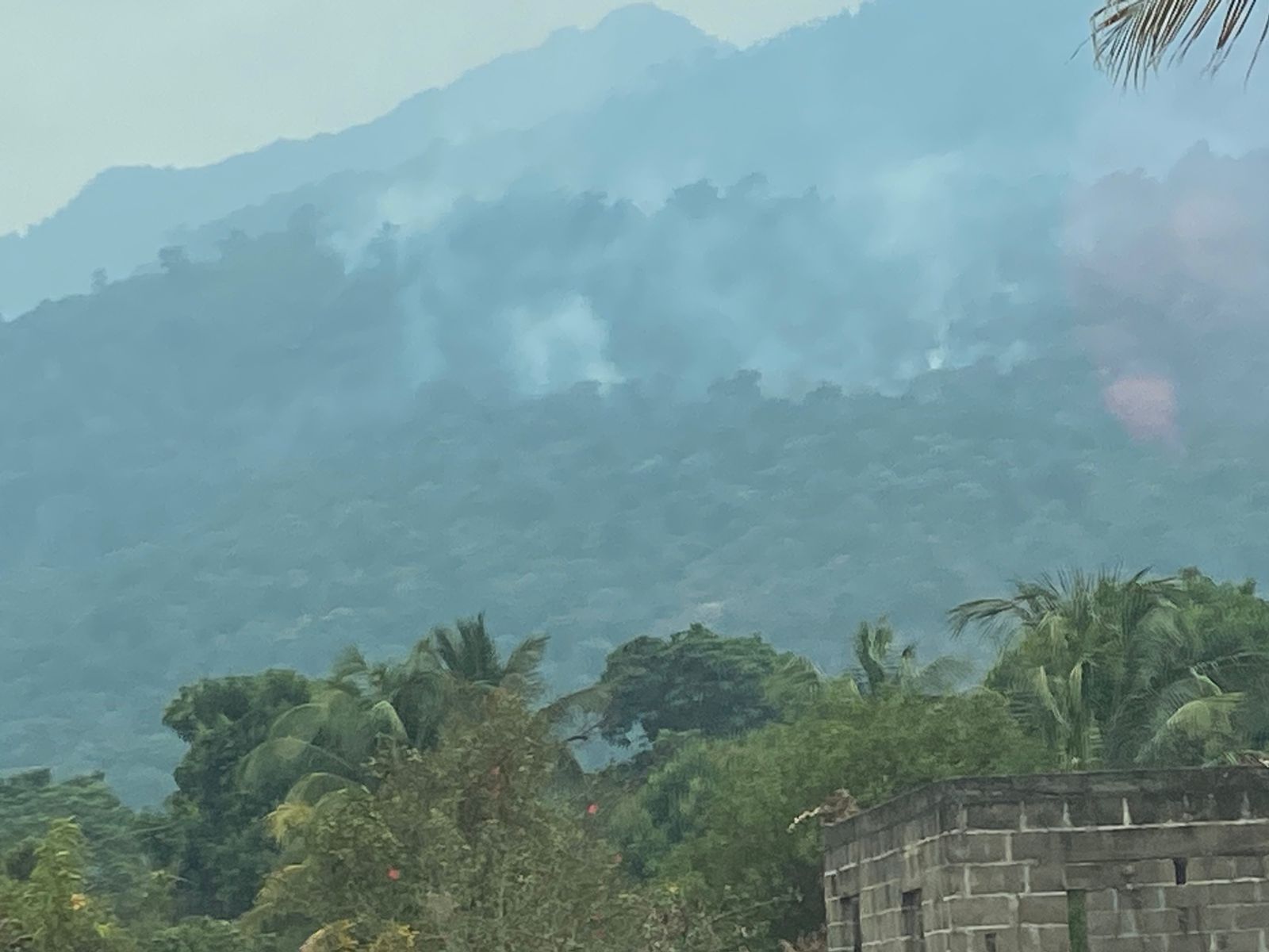
However, the fire found another path. It raged along the Kanuku Mountains, affecting villages such as Moco Moco and Kumu with persistent smoke. Guyana’s Civil Defence Commission (CDC) said heavy rainfall had temporarily doused some fires days earlier, but the relief was short-lived.
Two days later, on March 13, Guyana recorded its first and only reported case of death by wildfire for this year. Alexander Josephine, 93, a respected member of the Parakies Village community in the North West district of Region 9, sustained severe burns as a wildfire destroyed his farm. The injuries were fatal.
The CDC reported that auxiliary firefighters were activated to support the Region 9 fire service station and that firefighting gear and relief items were distributed to affected villages.
This was just the beginning of the unprecedented wildfire crisis Guyana faced in March and April, which tested the effectiveness of its emergency response systems.
The South Rupununi Conservation Society (SRCS) explained that through anecdotal information, there is an indication in the Rupununi of longer dry periods or more abrupt changes in weather and climate patterns. Located in South Rupununi, SRCS is a grassroots conservation NGO. Since 2002, the Society has dedicated itself to conserving the wildlife, environment, and culture of Guyana’s Rupununi region. Its approach focuses on community-based conservation, environmental education, and research initiatives.
SRCS said, “To understand the effects of climate change on fire occurrence, we would need more empirical data to understand how the climate is shifting over the past 50 or so years. We would need to understand how climate change has affected the wet/dry cycles and how the changes in the wet/dry cycles impact fires.”
According to the NGO, wildfires in the region are complex issues influenced by factors beyond climate change, such as shifts in land use, local burning practices, and changes in vegetation types. Research on these interactions remains insufficient both within the Rupununi and across Guyana. “With regards to impact on biodiversity, we have data from our ongoing research and conservation programmes to show that many refuge areas, including important breeding sites and habitats were destroyed by the recent wildfires and its recovery will take time and depend highly on favourable climate. Our camera trap data shows some areas burnt in January 2024 have in no way recovered their biodiversity in June 2024.”
The SRCS added that adapting local livelihoods and conservation strategies to mitigate these unpredictable occurrences presents significant challenges. It sees addressing research gaps related to fire dynamics, climate change impacts, vegetation dynamics, and wildlife in the Rupununi as crucial for developing effective strategies and policies.
While wildfires are not unusual for some parts of Guyana, like the Rupununi, during the climatic phenomenon known as El Niño, the intensity of the heat of the 2024 dry season saw blazes spread more widely across the country.
Supported by learnings from the United States’ National Oceanic and Atmospheric Administration (NOAA), the Guyana EPA said that global warming has led to contributing factors for wildfires, such as extended dry seasons and droughts. The regulator said that dry soil and vegetation, low precipitation, wind speed, and humidity significantly impact climate variability and change by creating conditions where a small spark can ignite a wildfire, which then spreads rapidly and intensely due to the lack of moisture.
“The combination of these factors can lead to larger, more destructive wildfires that can devastate ecosystems,” the EPA stated.
Guyana’s story finds company with its neighbours across Central and South America, which also faced wildfires due to the raging heat of the dry season. With its extensive forest cover, Guyana is increasingly vulnerable to these threats due to prolonged dry seasons and rising temperatures, impacting indigenous communities reliant on forests. While natural wildfires may be rare in tropical rainforests due to high humidity, the situation is complicated by a warming planet.
The United States’ NOAA said March 2024 was the “warmest March on record for the globe” in the agency’s 175-year record. The March global surface temperature was 1.35°C above the 20th-century average of 12.7°C. It described the temperatures throughout much of South America as “record warm”.
Meanwhile, the United Kingdom’s National Meteorological Service’s (Met) forecast indicates that the average global temperature for 2024 will be between 1.34°C and 1.58°C above the average for the pre-industrial period. The Met office said it would be the first time the average global temperature temporarily exceeds the target limit set by world leaders in the 2015 Paris Agreement.
This story was published with the support of the Caribbean Climate Justice Journalism Fellowship, which is a joint venture of Climate Tracker and Open Society Foundations.


