The Ministry of Natural Resources has introduced two innovative online platforms designed to enhance transparency and efficiency in the allocation of mining and forestry areas in Guyana. These platforms, launched on Wednesday, provide detailed maps showing the allocation of resources managed by the Guyana Geology and Mines Commission (GGMC) and the Guyana Forestry Commission (GFC).
The GGMC’s Mineral Tenure and GFC Forrest Allocation Map can both be accessed through the respective agencies’ websites. Both platforms are publicly accessible at no cost and were developed in collaboration with the U.S. government.
Omkar Lochan, Head of Policy Planning and Coordination at the Ministry of Natural Resources, conducted a live demonstration to explain how citizens can navigate and utilize the platforms. He highlighted that the platforms, powered by the Kadaster platform—a global nonprofit organization that provides geospatial tools and technologies—allows government agencies to store, analyze, and share geospatial data effectively. He also disclosed that GGMC and GFC are the primary users of this data in Guyana.
In relation to the GGMC Mineral Tenure, Lochan noted that each mineral property has been allocated a unique identification number on the map to facilitate easy identification. “Each data point has attributes as well, you will see the file number, you will see the applicant, the application date, the type of permit and acreage,” he explained. The map is also searchable by large-scale or medium-scale operations, making it user-friendly.
However, Lochan pointed out that small-scale claims are not yet included on the map. “But persons could go into the GGMC and request that,” he added.
The platform also allows users to view surrounding properties and natural features like rivers. Additionally, it includes other options to view protected areas, Amerindian titled lands, and quarries. Notably, users can also download the information available on the map.
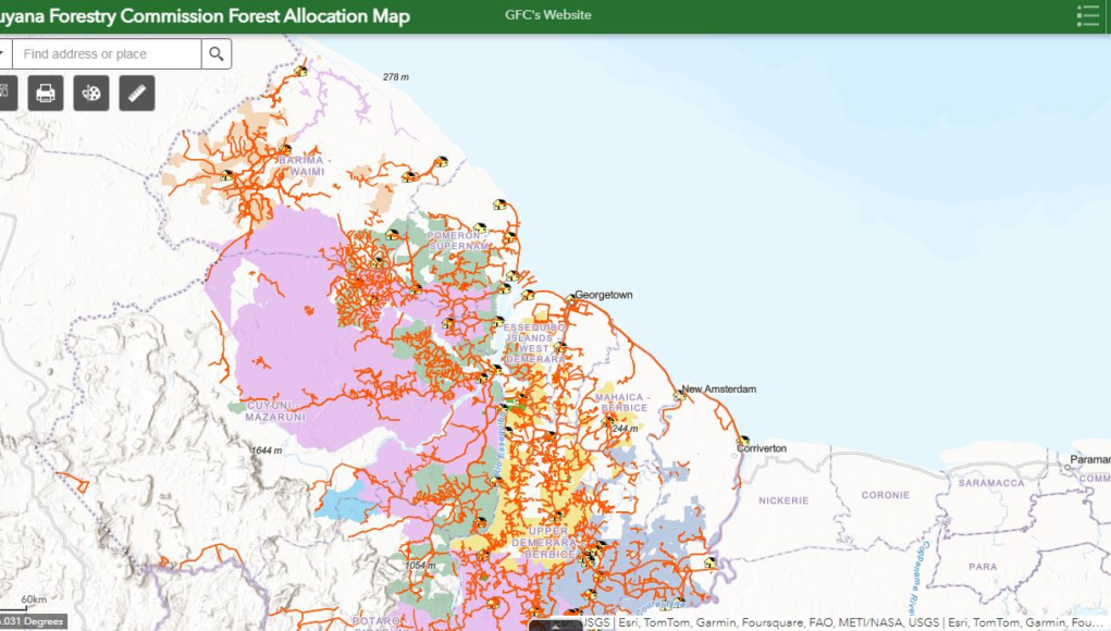
Regarding the Forestry Resource Allocation Map, Lochan demonstrated how users can search for forestry concessions on the platform, which can be accessed through the Guyana Forestry Commission’s website. He added that the platform is used internally by the GFC to manage field operations and locate stations and concessions.
“The other thing that is on this map is the saw mills and the lumber yards…address and contact number,” Lochan said.
Further, he stressed the operational benefits of the platforms, particularly the inclusion of the national road network, which encompasses both asphalt roads and trails. He stated that this feature is especially useful for planning infrastructure developments, such as budgeting for new roads when allocating land through lotteries or auctions.
The GGMC’s Mineral Tenure can be accessed (https://storymaps.arcgis.com/stories/790ce0003be5464a815be1862ff594d9),, “”) while the Forestry Resource Allocation Map is available here (https://cadasta.maps.arcgis.com/apps/webappviewer/index.html?id=e543e1d1d8f04bc29e16b448cd0beb76.) “smartCard-inline”)


